What might it look like from Portland if Mount Hood erupts?

A recent article in the Oregonian highlighted a youtube video showing what it might look like from Portland if Mount Hood erupted. The video shows a growing ash cloud above the mountain, as viewed from the perspective of a busy Portland street.

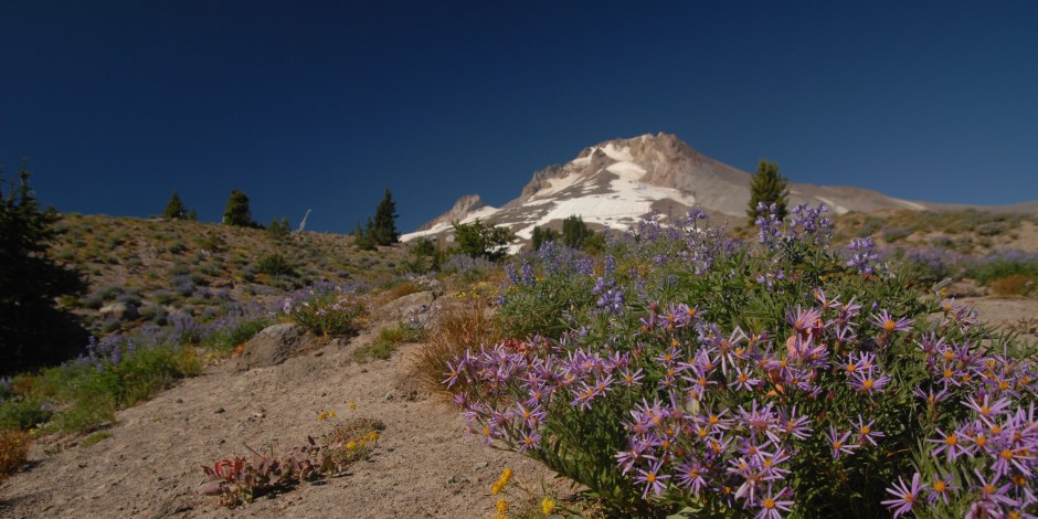
From what we know of past activity at Mount Hood, what did the video get right? Well – for a start the ash cloud in the video comes from near the summit, where the most recent eruptions of Mount Hood have occurred – both the Old Maid and Timberline eruptions (occurring ~220 and ~1500 years ago) were at Crater Rock, on the south side of the current summit.

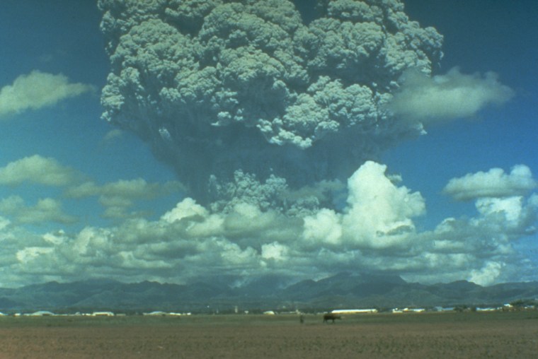
The ash cloud also seems to mostly show convective transport of ash – driven by hot gases that are less dense and thus buoyant. We don’t see large ash clouds driven upward by being expelled at high velocity from a narrow magma conduit – such as would occur in a  big Plinian eruption when there is an open pathway between a pressurized magma reservoir and the surface (think of a firehose). Plinian eruptions are named after Pliny the Younger who documented the eruption of Vesuvius is 79 AD that buried Pompeii. The ash clouds that such blasts produce are much larger and can reach up into the stratosphere. Take the example below from Mount Pinatubo in 1991.

plumefield
Mount Pinatubo, Philippines, June 1991 (USGS photo)

For Mount Hood there is no geological evidence of this type of large eruption that has occurred in the past. Eruptions at Mount Hood are smaller and typically involve growth of lava domes or lava flows. Explosions can still occur – via interaction between magma and water, or some sudden release of pressure within the lava dome. These smaller eruptions might produce an ash cloud similar to that in the fictional video – similar to this one from Sakurajima volcano in Japan from 2014.

The lava dome can also collapse and fall down the side of the volcano – and this could also produce pyroclastic flows (literally gravity driven flows of “fire particles”). In fact one nice addition to the video would be to add a source of ash moving down the side of the mountain to represent a pyroclastic flow – like seen in this video from Batu Tara volcano (starting about 1 minute in).

One thing that is definitely wrong – the loud sound of an explosion is heard about 30 seconds after the first ash is visible. Volcanic eruptions can produced very loud sounds, but as sound travels about 330 meters per second at sea level 30 seconds is not enough for the bang to be heard in Portland, that would take several minutes ( almost 4 by my calculations).

Get your hot blocks here!

If you take a walk sometime above Timberline Lodge, up towards the Palmer snowfield, and look around you are likely to come across some of these strange fractured rocks shown in the above photo. These are some of my favourite geological features at Mount Hood, and they tell an important part of the story of the Timberline eruption – the second most recent Mount Hood eruption, which occurred about 1500 AD.

The Timberline eruption started with the formation of a lava dome at Mount Hood’s summit – near the present location of Crater Rock. However the really notable thing about that eruption is that at some point a very big collapse event also occurred – basically the southern third or so of the summit crater fell off and down the mountain. This event completely changed the southern side of volcano by producing the “smooth” surface (a surface of minimum slope) that Timberline lodge sits on today.

Note that these sort of sector collapse type events are not that rare at big volcanoes (witness Mount St Helens in 1980, and a really big one happened at Mount Shasta about 300,000 years ago or so). Sometimes collapse events occur without an eruption – as the rocks of volcanoes are weakened by alteration and can’t hold the mass of edifice up. This sort of thing has happened repeatedly at Mount Rainier over the last 10,00 years, for example.

img298
A USGS photo showing the hummocky terrane at the base of the northwest side of Mount Shasta. Although it not realized until after Mount St Helens, the hummocks formed in major sector collapse/landslide event 300,000 years ago.

However at Mount Hood we know that the Timberline collapse DID occur during an eruption – and one important evidence are the blocks with the odd wiggly fractures in them. The fractures in these rocks, known as polygonal fractures, are the type of fracture that occurs when a rock is really hot and then cools quickly. The fractures also form after the rock has come to rest in its current position – because the rock is so broken up it would fall completely apart if it moved any more after cooling. The way that the polygonally jointed blocks form is to be part of the hot lava dome at the summit that periodically collapses down the mountain. The superheated blocks tumble down the mountain and once they come to rest they cool quickly and develop the polygonal fractures. Some of these are really quite large – Timberline Lodge would have been an interesting place to be 1500 years ago.

img_2861
A really big polygonally jointed block from just above Timberline Lodge

Welcome!

Hello! My Name is Adam Kent, I am a professor of geology in the College of Earth, Ocean, and Atmospheric Sciences at Oregon State University. I have been researching the geology of Mount Hood since 2003, with a focus on understanding how this amazing volcano works.

For several years I have been wanting to put together a website that functions as a resource for everyone interested in Mount Hood. The goal is to provide a one stop clearinghouse where anyone – academic researchers, interested members of the public, etc. – can come to find information about Oregon’s highest mountain and most recent volcano.

I plan to keep building the site, so please let me know if you have suggestions, comments or questions about Mount Hood or other Cascade volcanoes.