Recent activity at Hawaii’s Kilauea volcano has shown some of the dramatic phenomena that commonly attend this type of eruption. Fissures that seep gas and lava, showers of incandescent lava spatter, and long snaking lava flows. These types of eruption are common at many volcanic islands, such as Hawaii, which predominantly erupt runny basalt lavas.
Subduction zones, such as the Cascade Range of the Pacific Northwest are typically associated with different styles of volcanic eruptions. Volcanoes like Mount Hood, the Three Sisters, and Mount Rainier mostly erupt more silica-rich rich and sticky andesites, dacites and related magmas. These tend to form lava domes and short lava flows, and the occasional pyroclastic flow. The end result are the well known steeper sided Cascade volcanoes, technically known as stratovolcanoes.
So Oregon, lying as it does on a subduction zone, shouldn’t expect to see eruptions like we are currently seeing in Hawaii – right? Well, actually no. Basalt volcanoes that are quite similar to Hawaiian volcanoes are less common on subduction zones, but do occur, and Oregon has some great examples. What’s more, eruptions have occurred in the relatively recent past in Oregon that would have looked quite similar to what we are seeing unfolding today at Kilauea.

One good example is the well known cinder cone of Lava Butte, located just next to highway 97 to the south of Bend. This small cone is part of the broader and massive Newberry Volcano shield volcano near La Pine. Lava Butte formed in a short eruption about 7000 years ago – one of the younger eruptions associated with Newberry. Today, Lava Butte has a fantastic visitors center, ranger talks, and self-guided hikes (including accessible paved paths through the lava) via the Deschutes National Forest Lava Land Visitors Center.
High-resolution topography from the Oregon LIDAR repository (highly recommended for a snoop and maintained by DOGAMI) reveal a typical sequence of events for this type of eruption. It started with a fissure eruption where a number of smaller volcanic vents occur spaced along a single fracture. After this activity then rapidly narrowed to focus at one location to produce a good size cinder cone. Finally large amounts of lava issued from this cone to form a broad lava flow field (about 95% of the magma erupted is in this lava flow). This same chain of events occurs in many basaltic eruptions, and we could be in the first phase of this sequence currently in Hawaii. You can see each of these phases in the annotated LIDAR images.

At Lava Butte the earliest activity formed a chain of small volcanic cents spaced along a fissure that lies across highway 97 to the south east of the main cone. These would have looked very similar to what we saw in Hawaii, with incandescent globs of lava (termed “spatter”) thrown up into the air and falling to build up small mounds on either side of the fissure, together with smaller lava flows. The line of these smaller vents is also near a fault “scarp” – a step in the landscape produced by movement along a fault, although the exact relationship between the fault and the eruptions are still being sorted out.

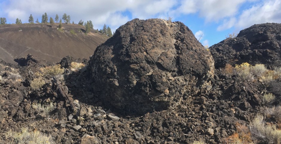
The Lava Butte cinder cone formed when eruption focused down to a single point along the fissure (a very common observation and something that may yet happen in Hawaii) and falling scoria built up into the large Lava Butte cone we see today. Scoria cones typically build up from relatively gassy lava. Once the gas runs out the eruption can change to a more gentle effusion to form lava flows. Cinder cones like this are very common in the Central Oregon area. Pilot Butte, which lies within the Bend city limits, is another good example.

Once the cinder cone reached a good size at Lava Butte, less gas-rich lava started issuing from the crack in the base of the cone. This produced a type of lava delta, with levees (high banks) and multiple lava channels. The lava flowed north and west, blocking and displacing the Deschutes River. The temporary lake that formed is now called Lake Benham. The effect on the river is clear on the LIDAR images – the channel moved to the west and now lies along the margin of the lava flow As Lake Benham drained it also cut a new channel through a ridge of older rock. This is location of Benham Falls, a popular viewing point, hiking and cycling destination south of Bend.
So while you are watching the spectacular images of from Hawaii, remember that we have had similar eruptions in the past in Oregon, and in all likelihood will have them again in the future.
