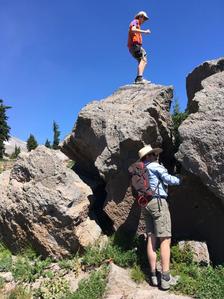
Mount Hood research featured in Beaver Nation

Mount Hood research featured in Beaver Nation
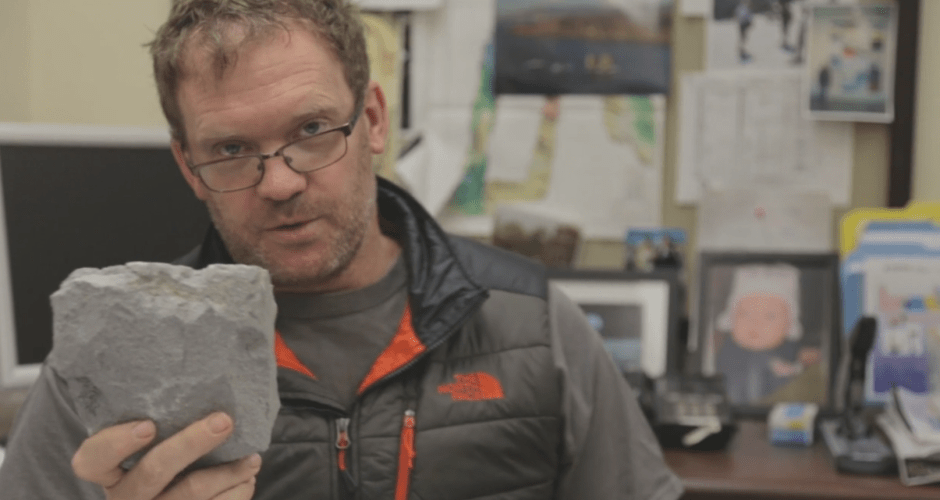
Hello! My Name is Adam Kent, I am a professor of geology in the College of Earth, Ocean, and Atmospheric Sciences at Oregon State University. I have been researching the geology of Mount Hood since 2003, with a focus on understanding how this amazing volcano works.
For several years I have been wanting to put together a website that functions as a resource for everyone interested in Mount Hood. The goal is to provide a one stop clearinghouse where anyone – academic researchers, interested members of the public, etc. – can come to find information about Oregon’s highest mountain and most recent volcano.
I plan to keep building the site, so please let me know if you have suggestions, comments or questions about Mount Hood or other Cascade volcanoes.
Recent activity at Hawaii’s Kilauea volcano has shown some of the dramatic phenomena that commonly attend this type of eruption. Fissures that seep gas and lava, showers of incandescent lava spatter, and long snaking lava flows. These types of eruption are common at many volcanic islands, such as Hawaii, which predominantly erupt runny basalt lavas.
Subduction zones, such as the Cascade Range of the Pacific Northwest are typically associated with different styles of volcanic eruptions. Volcanoes like Mount Hood, the Three Sisters, and Mount Rainier mostly erupt more silica-rich rich and sticky andesites, dacites and related magmas. These tend to form lava domes and short lava flows, and the occasional pyroclastic flow. The end result are the well known steeper sided Cascade volcanoes, technically known as stratovolcanoes.
So Oregon, lying as it does on a subduction zone, shouldn’t expect to see eruptions like we are currently seeing in Hawaii – right? Well, actually no. Basalt volcanoes that are quite similar to Hawaiian volcanoes are less common on subduction zones, but do occur, and Oregon has some great examples. What’s more, eruptions have occurred in the relatively recent past in Oregon that would have looked quite similar to what we are seeing unfolding today at Kilauea.

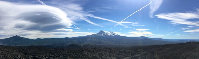
One good example is the well known cinder cone of Lava Butte, located just next to highway 97 to the south of Bend. This small cone is part of the broader and massive Newberry Volcano shield volcano near La Pine. Lava Butte formed in a short eruption about 7000 years ago – one of the younger eruptions associated with Newberry. Today, Lava Butte has a fantastic visitors center, ranger talks, and self-guided hikes (including accessible paved paths through the lava) via the Deschutes National Forest Lava Land Visitors Center.
High-resolution topography from the Oregon LIDAR repository (highly recommended for a snoop and maintained by DOGAMI) reveal a typical sequence of events for this type of eruption. It started with a fissure eruption where a number of smaller volcanic vents occur spaced along a single fracture. After this activity then rapidly narrowed to focus at one location to produce a good size cinder cone. Finally large amounts of lava issued from this cone to form a broad lava flow field (about 95% of the magma erupted is in this lava flow). This same chain of events occurs in many basaltic eruptions, and we could be in the first phase of this sequence currently in Hawaii. You can see each of these phases in the annotated LIDAR images.

At Lava Butte the earliest activity formed a chain of small volcanic cents spaced along a fissure that lies across highway 97 to the south east of the main cone. These would have looked very similar to what we saw in Hawaii, with incandescent globs of lava (termed “spatter”) thrown up into the air and falling to build up small mounds on either side of the fissure, together with smaller lava flows. The line of these smaller vents is also near a fault “scarp” – a step in the landscape produced by movement along a fault, although the exact relationship between the fault and the eruptions are still being sorted out.

The Lava Butte cinder cone formed when eruption focused down to a single point along the fissure (a very common observation and something that may yet happen in Hawaii) and falling scoria built up into the large Lava Butte cone we see today. Scoria cones typically build up from relatively gassy lava. Once the gas runs out the eruption can change to a more gentle effusion to form lava flows. Cinder cones like this are very common in the Central Oregon area. Pilot Butte, which lies within the Bend city limits, is another good example.

Once the cinder cone reached a good size at Lava Butte, less gas-rich lava started issuing from the crack in the base of the cone. This produced a type of lava delta, with levees (high banks) and multiple lava channels. The lava flowed north and west, blocking and displacing the Deschutes River. The temporary lake that formed is now called Lake Benham. The effect on the river is clear on the LIDAR images – the channel moved to the west and now lies along the margin of the lava flow As Lake Benham drained it also cut a new channel through a ridge of older rock. This is location of Benham Falls, a popular viewing point, hiking and cycling destination south of Bend.
So while you are watching the spectacular images of from Hawaii, remember that we have had similar eruptions in the past in Oregon, and in all likelihood will have them again in the future.

The upcoming US eclipse is projected to have people flocking to the regions of the country that will experience totality. One of these areas is Central Oregon – where in addition to several minutes of near complete darkness – you will find yourself in the middle of a volcanic wonderland. So, if you find yourself with some time in the area and want to hike and explore some of the amazing volcanic features, then here are some of my own recommendations.
(Note that I am NOT recommending you do these hikes to see the eclipse itself. From all accounts, it is going to be a zoo out there, and probably all trail heads and moderately easy to get to peaks will be swamped. If it was me I’d save these hikes for times when there aren’t going to be thousands of other people along for the ride. Also before anyone gets upset about a big reveal here, these are all well-known and easily accessible central Oregon hikes. I am not giving away any secrets, except maybe when I add my *bonus* fishing recommendations, which to be honest may be more of a liability than asset. Finally – I have not tried to supply exhaustive details about each hike here but there is plenty of information available online regarding distances, elevation etc. Finally, finally, water is rarely available on these hikes in summer so make sure you carry enough with you).

Tam McArthur Rim. One of the most classic of short Cascade hikes. It will take a few hours to do the 5 miles out and back, but O boy will it be worth it. Start at Three Creeks Lake, by driving 17 miles south from Sisters, OR, following Forest Road 16 (turn on Elm Street in Sisters). Hike from lake level, up 1300′ into the heart if the Tam MacArthur Rim volcano – a heavily glaciated Pleistocene shield volcano where the stacked lava flows form a long and aesthetic rim. Near the start of the hike go past a nice platy andesite where the plates themselves are gently folded. Then head steeply up to the crest of the rim. The last part of the hike is mostly on the more gently sloped south side of the rim, with great views out to the south to Mount Bachelor and Broken Top areas. There is a last slog uphill to the prow of the rim, with spectacular 360° views extending from the Three Sisters to Mounts Jefferson Washington and Hood to the north, the flatter lands of Eastern Oregon and down to Three Creeks Lake and Little Three Creek Lakes hosted in cirques far below. Look for nice obsidian in the 200,000 year old rhyodacite dome at the top and admire the steep cliffs cut by dykes (but be careful near cliff’s edge). Also a good place to spot spring skiing lines.

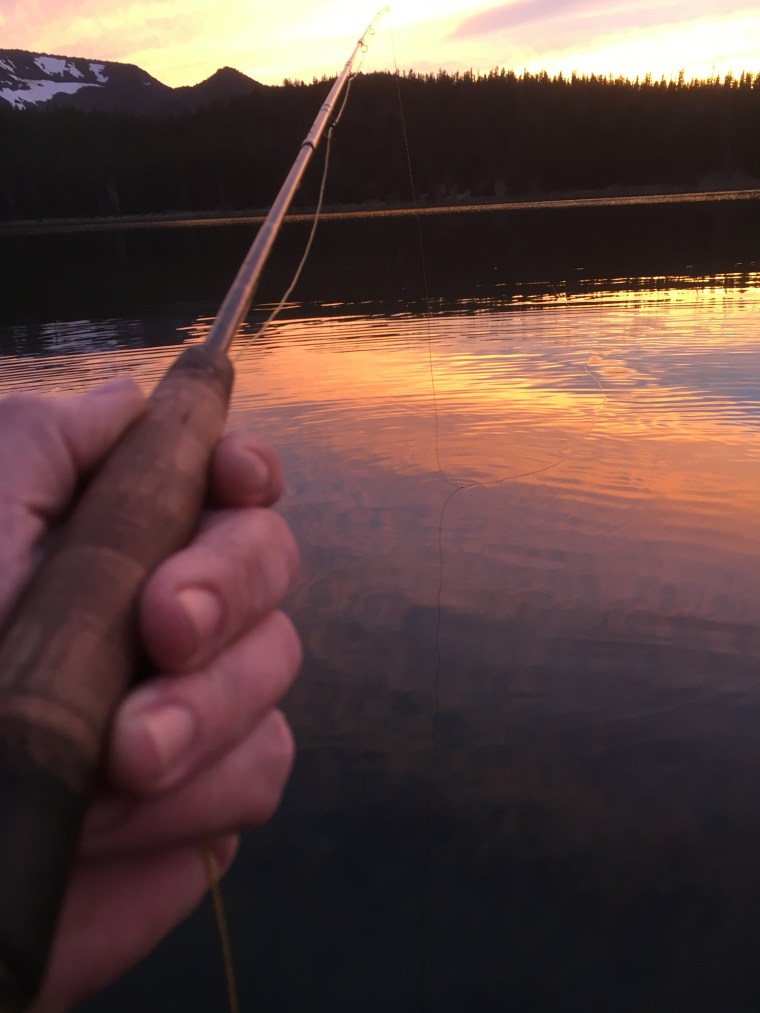
Descend the way you came up to cool your feet in the lake. If you fly fish try small callibaetis dries in the late afternoon and/or something bigger and leggy near sunset. A boat is useful but not necessary, with plenty of risers near shore. The lake has planted rainbow trout and some naturally spawning brook trout.
Black Butte. The almost perfect cone of Black Butte rises about 10 miles NW of Sisters. Although the volcano is youthful looking in it symmetric form, it is actually older than jaggedly eroded Mount Washington, visible about 10 miles to the southeast. Why? Sitting further east in the rain shadow of the Cascades, Black Butte receives much lower snowfall than the Cascade crest and as a result has never been glacially eroded, which just shows what an effective agent of erosion mountain glaciers are.
Access the trailhead via Green Ridge Road (Forest Rd 11) after heading NW out of Sisters on Highway 20 to milepost 95. After 3.8 miles, turn left onto Road 1110 for 5.1 miles. The trail starts in cool Ponderosa forest before heading out on the drier and sunnier south side of the Butte. Follow the trail to the top (about 2 miles) and return on the same path. Enjoy the panoramic views from east of the cascade crest (which is also why this has been used for many years as a fire lookout – see the modern lookout and remains of several earlier structures). Also note the long straight Green Ridge, which lies north of Black Butte, between you and Mount Jefferson. This is one of the few major topographic features in this area not related to volcanism. Green Ridge is a long fault scarp related to faulting and uplift along the Cascade Arc in this area, which started at least 5-6 million years ago. The spring-fed Metolius River runs north along the base of the scarp before busting east to meet the Deschutes and Crooked Rivers at Lake Billy Chinook. After the hike head to Camp Sherman (accessed via Road 14 on the other side of the Butte) for drinks and snacks. The Metolius also has world class fly fishing, but check in at the Fly Fishers place in Sisters first, as I’ve never really cracked that place. If you can time the green drakes all luck to you. The Metolius is almost completely spring fed, but curiously the springs are not fed by snows on Black Butte – oxygen isotope signatures show the water comes from infiltration in the swampy region further south of the butte. Like many of these spring fed Cascade rivers Metolius water is REALLY cold. Wear waders and be careful.
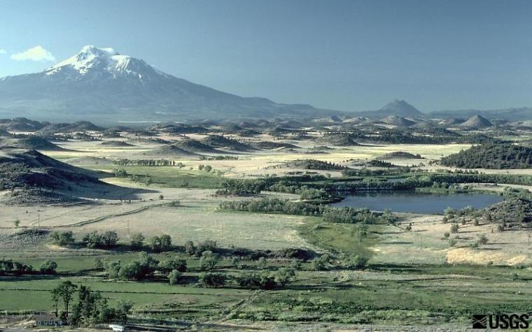
Lava Butte. Newberry Volcano (in itself a great destination to see volcano-hosted lakes and obsidian flows) is one huge thing – and it dwarfs all the more famous Cascade peaks. Visible on the skyline south and east from Bend Newberry is a shield volcano that can hide in clear sight. This is because it has lower angle slopes than the more gaudy and spiky stratovolacanoes. The only other Cascade volcano to rival Newberry in size is Medicine Lake volcano – likewise a shield volcano – that lies east of Mount Shasta. The numbers on Newberry are pretty staggering – almost 500 km3 volume and covering 1300 km2 in area (compare that to, for example, 150 km3 volume for Mount Rainier). Lava flows from Newberry travelled as far away as Smith Rock, 70 km to the north.
One of the most recent eruptions on the flank of Newberry is the cinder cone and flow of 7700 year old Lava Butte – located conveniently off Highway 97. There is a great Forest Service visitors center with displays about Central Oregon volcanoes, and you can take a shuttle to the top. There are several hikes to recommend. One is the short tour around the crater at the top with views of the Cascade crest. You can also take an excellent self-guided hike through the lava flow that issued from the base of the cinder cone. Generally walking on young lava flows is hard work and can be really nasty (ask any volcanologist), but in this case, there is a nice smooth path of almost a mile that takes you up to base of the cone where the lava flow started and points out many other features of note enroute. A significant length of the trail is universal access too. Finally, you can also drive or follow trails (bike friendly) down to the Deschutes River and hike along to Benham Falls. The Deschutes River is unusually fast flowing and cascade-rich here, which is the geomorphic result of the Lava Butte lava flow damming the river and shifting its channel west to the edge of the lava flow (the flow is easily visible just across the river). At one stage water backed up behind this flow to create Lake Benham – which extended up to 30 miles upstream from present day Benham Falls.
South Sister. This is big kahuna of one day central Oregon hikes (although it is also possible to camp part way up), and is another Oregon classic. Ascend the second highest mountain in the state via a mostly OK, but sometimes quite sketchy – and definitely tiring – trail. It is tough, but if you are fit, a reasonably accomplished hiker, carry enough water, and like to enjoy magnificent views then this might just be for you. The most popular trailhead is Devils Lake, located off the Cascade Lakes Scenic Highway, about 20 miles west of Bend (just follow Century Drive out of town to the west). This is the same road you would take to Mount Bachelor ski area. From the trailhead it is a 12 mile and 5000’ elevation gain, out and back trail. The trail starts up a narrow canyon and soon reaches a gentle sloped apron around the mountain itself. From here slog up the at times indistinct trail to the moraine dammed lake below the Lewis Glacier. Keep track of your altitude by looking over at Mount Bachelor (9068’) occasionally. Gather yourself for the final section up past the Lewis Glacier on loose scoria to the top. This can be a “two step up slide three back” sort of trail but persist, as it is worth it. The actual true summit is across the other side of the mountain from where the trail ascends, so make sure you head around there and enjoy the unbelievably awesome views of Middle and North Sister. Be careful of the steep northern face on that side too! South Sister has some of the youngest volcanic rocks in this part of the Cascades and is also one of the only places in the Cascades that erupts true rhyolite. Although rhyolite can erupt explosively it can also form lava flows, and you can see great example of this looking back to the southwest as you ascend and see the unmistakable squashed pancake of the Rock Mesa flow – highly viscous rhyolite magma erupted about 2400 years ago. Once you get down you’ll obviously want to go fishing, so continue along the Cascade Lakes Scenic Highway for access to many excellent lakes. I’d recommend Lava Lake and Little Lava lake for some reasonable bank access and to fish the head waters of the fabled Deschutes River.
Little Belknap Crater. This really is one of my absolute favourite hikes in Central Oregon. Here is my suggested itinerary. Drive to MacKenzie Pass on the MacKenzie Highway (242) out of Sisters (heading west). Stop in Sisters for coffee and baked goods at the Sisters Coffee Company and peruse Paulina Springs Book store should you so wish. Drive about 20 miles up gentle sloped and forested old lava flows to get to the pass. This is an area with many large and relatively young (less than a few thousand year old) lava flows from multiple volcanic vents. Stop at the pass itself and explore the quirky Dee Wright observatory, a castellated depression era construction with a special treat in the second floor for mountain spotters (no spoiler here though). There are also restrooms, information boards, and a few nice self-guided hikes through the young lava fields. Flows from multiple vents converge here, including Yapoah Crater, Collier Cone and Four in One Cone to the south of road (these vents snuggle up into the north side of North Sister – the eroded remnant of a Pleistocene shield volcano), and Belknap Crater and associated Little Belknap Crater off to the northwest. Most lava flows in the vicinity of the lookout are between 1200-3000 years old, but to my eye they look even younger. This is because the very high porosity of the flows stops water accumulating here and limits vegetation growth – even though the pass receives many feet of snowfall every winter. Look around – see any creeks or rivers? All water drainage is in the subsurface and melted snow feeds the many cold and hot springs found at lower elevations. It takes about 2-10 years for water to get from the pass to come out in springs that feed the upper MacKenzie River.
To hike drive a mile or so past the Dee Wright observatory and park at the Little Belknap trailhead. Hike from here up along the Pacific Crest Trail first through two forested Kipuka’s (a Hawaiian word for areas of forest isolated by lava flows surrounding them.

Then hike up through great lava flow topography of the ca 3000 year old flow from Little Belknap – the reddish vent that you can see up to the north east of the trail. After a while take the turn to the right for Little Belknap (east). Walk up past a collapsed lava tube (which you can explore carefully for a surprise) and scramble up crunchy lava and the wonderfully named “agglutinated spatter” (blobs of lava ejected at a vent that fall back to the ground and are hot enough to glue themselves together) for expansive views at the summit of lavas flows and Mounts Washington, Jefferson, Three Finger Jack and North and Middle Sister to the south. Try not to trip here as the lava and scoria are sharp, and would be nasty to fall on. Enjoy the summit and return the way you came being nice and giving way to people with big packs slogging it up the Pacific Crest Trail.
Make a day trip by continuing down the steep and windy MacKenzie Pass to the west and then return to Central Oregon via Santiam Pass. You can also visit Clear Lake – formed when lava flows from the Sand Mountain chain at Santiam Pass blocked the Mackenzie River about 3000 years ago. You can still see old trees preserved in the depths of lake here, and fishing is meant to be good too.
That’s my list, but there are so many other good volcanic hikes in Central Oregon! Some others you could look at, but that I am not going to describe here, are Black Crater, Paulina Peak, Tumalo Mountain, Smith Rock, Four in One Cone, Collier Cone and Camp Lake in the saddle between Middle and South Sister. Maybe I’ll do another post someday. Let me know if you would like that.
A recent article in the Oregonian highlighted a youtube video showing what it might look like from Portland if Mount Hood erupted. The video shows a growing ash cloud above the mountain, as viewed from the perspective of a busy Portland street.
From what we know of past activity at Mount Hood, what did the video get right? Well – for a start the ash cloud in the video comes from near the summit, where the most recent eruptions of Mount Hood have occurred – both the Old Maid and Timberline eruptions (occurring ~220 and ~1500 years ago) were at Crater Rock, on the south side of the current summit.
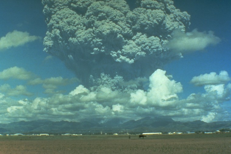
The ash cloud also seems to mostly show convective transport of ash – driven by hot gases that are less dense and thus buoyant. We don’t see large ash clouds driven upward by being expelled at high velocity from a narrow magma conduit – such as would occur in a big Plinian eruption when there is an open pathway between a pressurized magma reservoir and the surface (think of a firehose). Plinian eruptions are named after Pliny the Younger who documented the eruption of Vesuvius is 79 AD that buried Pompeii. The ash clouds that such blasts produce are much larger and can reach up into the stratosphere. Take the example below from Mount Pinatubo in 1991.
For Mount Hood there is no geological evidence of this type of large eruption that has occurred in the past. Eruptions at Mount Hood are smaller and typically involve growth of lava domes or lava flows. Explosions can still occur – via interaction between magma and water, or some sudden release of pressure within the lava dome. These smaller eruptions might produce an ash cloud similar to that in the fictional video – similar to this one from Sakurajima volcano in Japan from 2014.
The lava dome can also collapse and fall down the side of the volcano – and this could also produce pyroclastic flows (literally gravity driven flows of “fire particles”). In fact one nice addition to the video would be to add a source of ash moving down the side of the mountain to represent a pyroclastic flow – like seen in this video from Batu Tara volcano (starting about 1 minute in).
One thing that is definitely wrong – the loud sound of an explosion is heard about 30 seconds after the first ash is visible. Volcanic eruptions can produced very loud sounds, but as sound travels about 330 meters per second at sea level 30 seconds is not enough for the bang to be heard in Portland, that would take several minutes ( almost 4 by my calculations).
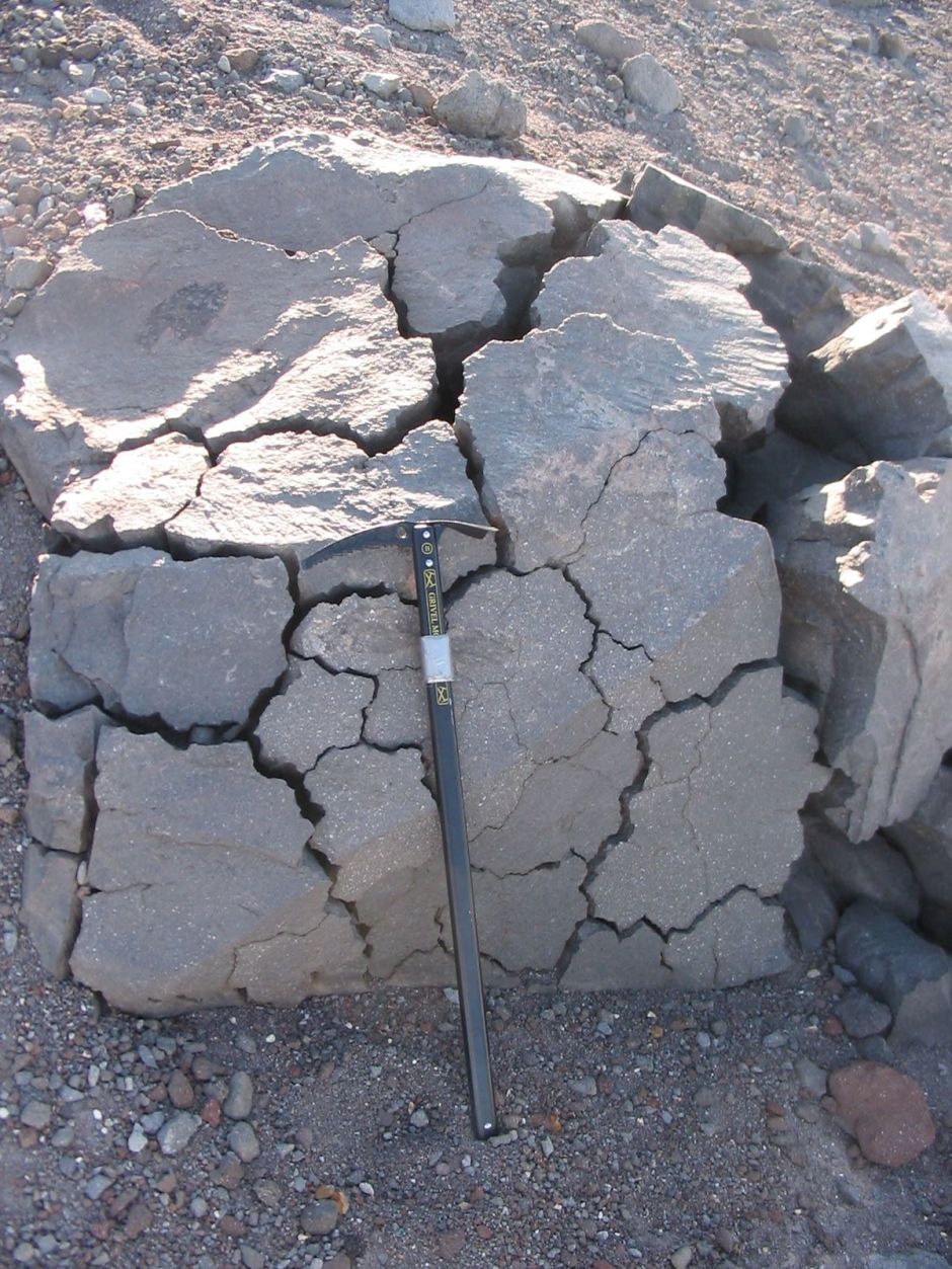
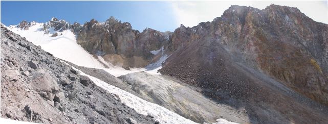
If you take a walk sometime above Timberline Lodge, up towards the Palmer snowfield, and look around you are likely to come across some of these strange fractured rocks shown in the above photo. These are some of my favourite geological features at Mount Hood, and they tell an important part of the story of the Timberline eruption – the second most recent Mount Hood eruption, which occurred about 1500 AD.
The Timberline eruption started with the formation of a lava dome at Mount Hood’s summit – near the present location of Crater Rock. However the really notable thing about that eruption is that at some point a very big collapse event also occurred – basically the southern third or so of the summit crater fell off and down the mountain. This event completely changed the southern side of volcano by producing the “smooth” surface (a surface of minimum slope) that Timberline lodge sits on today.
Note that these sort of sector collapse type events are not that rare at big volcanoes (witness Mount St Helens in 1980, and a really big one happened at Mount Shasta about 300,000 years ago or so). Sometimes collapse events occur without an eruption – as the rocks of volcanoes are weakened by alteration and can’t hold the mass of edifice up. This sort of thing has happened repeatedly at Mount Rainier over the last 10,00 years, for example.
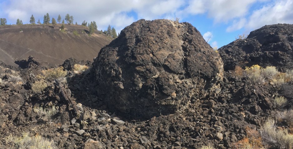
However at Mount Hood we know that the Timberline collapse DID occur during an eruption – and one important evidence are the blocks with the odd wiggly fractures in them. The fractures in these rocks, known as polygonal fractures, are the type of fracture that occurs when a rock is really hot and then cools quickly. The fractures also form after the rock has come to rest in its current position – because the rock is so broken up it would fall completely apart if it moved any more after cooling. The way that the polygonally jointed blocks form is to be part of the hot lava dome at the summit that periodically collapses down the mountain. The superheated blocks tumble down the mountain and once they come to rest they cool quickly and develop the polygonal fractures. Some of these are really quite large – Timberline Lodge would have been an interesting place to be 1500 years ago.